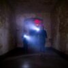
Nestled high in the mountains of north-central Arizona, the ghost town of Jerome lies about 115 miles north of Phoenix, 85 miles south of Flagstaff, and just 34 miles west of Sedona. Perched at nearly a mile high, Jerome provides awe-inspiring views overlooking lush Verde Valley from its steep roads clinging to Cleopatra Hill.
Directions to Jerome For Phoenix Area Visitors:
Take Interstate 17 North approximately 85 miles towards Flagstaff until you reach exit 289, Clarkdale/Jerome. Turn left off the exit ramp onto SR 89A heading west towards Jerome, which lies 3.8 miles from the interchange. The winding mountain road upto Jerome is extremely steep, so take caution.
Directions to Jerome For Flagstaff Area Visitors:
Drive Interstate 17 south for about 73 miles then take exit 293 for Cottonwood. Turn left onto SR 89A and continue east approximately 8 miles to reach the base of Jerome’s mountain entrance. From there follow signs leading up the snaking mountain road into Jerome proper. Allow at least 20 extra minutes for the slow but scenic 4 mile ascent.
Directions to Jerome For Sedona Area Visitors
Take SR 89A west toward Cottonwood through the scenic Oak Creek Canyon. Drive approximately 30 miles then turn right to remain on 89A heading towards Jerome. You’ll traverse the flatter valley before turning towards the mountains. From there allow 15 minutes to carefully navigate the narrow 4 mile mountain road that twists up to the hilltop ghost town.
Once in Jerome, ample parking can be found near the visitor’s center at the south end of town. Downtown Jerome lies along Main Street, while popular haunted stays include the Connor Hotel, Clinkscale Hotel, and the Jerome Grand Hotel situated within walking distance to key attractions. Just heed caution when exploring Jerome’s winding streets and extremely steep staircases between the upper and lower portions of town.